
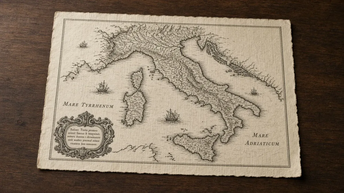
Dating Antique Italian Maps by Imprint, Paper and Colour
Collectors date antique Italian maps by imprint, paper and plate mark, from sixteenth-century Lafreri sheets through Magini, Coronelli and Zatta.
The date on an antique Italian map is rarely the date of the sheet in hand. Copper plates circulated for decades. Paper was stored. Binders trimmed margins and added new ones. A collector dates a map by reading imprint, paper and plate together, then matching that physical evidence to a workshop in Bologna, Rome, Venice or Naples.
Printed maps of Italy begin in the 1470s. They remain a distinct collecting field from painted views, Roman micromosaics and other Grand Tour souvenirs. The trade that produced them was a print trade. Its documents are shop signs, privileges, watermarks and the wear of a copper plate.
Copper plates from Bologna, Rome and Florence
The first printed edition of Ptolemy’s Geography appeared at Vicenza in 1475, without maps. The first edition with maps was issued at Bologna in 1477 by Dominicus de Lapis. The colophon prints the year as 1462. Contracts for the book prove the true date is 1477. The volume contains 26 copper-engraved maps. The Incunabula Short Title Catalogue records that this Bologna edition was never reprinted. Surviving copies are few.
Rome followed in 1478. Konrad Sweynheym began the plates. After his death in 1477, Arnold Buckinck completed the edition. It contains 27 maps, each printed from two copper plates on facing leaves. Lettering was punched into the metal rather than engraved freehand. The same plates were reused in 1490 and again in 1507 and 1508, when modern maps were added. A Rome Ptolemy map is therefore dated by the state of the plate, not by the year in the title.
Florence entered the sequence in 1482 with Francesco Berlinghieri’s Geographia, printed by Nicolaus Laurentii. The book adapts Ptolemy in Italian verse and includes 31 copper-engraved maps. The dedication to Federico da Montefeltro, Duke of Urbino, who died on 10 September 1482, supplies the terminal date. These three incunable campaigns established copper, not woodcut, as the Italian method for atlas maps.
Venice returned to copper in 1548. Giovanni Battista Pedrezano issued an Italian Ptolemy with maps by Giacomo Gastaldi of Piedmont, then working in Venice. The volume contains 60 double-page copperplate maps: 26 Ptolemaic and 34 modern. It is the first Italian-language Ptolemy and the first engraved Ptolemy since Berlinghieri. Gastaldi’s modern maps, not the classical tables, are the sheets that still appear on the market as separate leaves.
Sheet maps from Rome and Venice
From about 1544 a second Italian trade grew beside the atlas. Publishers in Rome and Venice sold single-sheet maps in many sizes, from a half sheet to eight sheets or more. They were not designed as a uniform set. Customers later had them bound. George Beans called those volumes IATO atlases, Italian assembled to order. Cataloguers still use the looser name Lafreri atlas, after Antonio Lafreri.
Lafreri was born Antoine Lafrère at Besançon in 1512. He settled in Rome about 1540. From 1553 to 1562 he worked in partnership with Antonio Salamanca. After the partnership ended he built the largest map and print shop in the city. In 1572 he issued a stock list, Indice delle tavole moderne di geografia della maggior parte del mondo. An engraved title, Tavole moderne di geografia, appears on some bound collections about 1570–72. That title page, not a claim to have drawn the maps, is why his name covers the whole school. He died in 1577. His nephew Claudio Duchetti succeeded him. Giovanni Orlandi reprinted many of the same plates in 1602.
Gastaldi remains the principal cartographer of the group. Robert W. Karrow described him as the greatest Italian mapmaker of his age. He did not usually sign as publisher. His name appears in titles, dedications and addresses to the reader. Fabio Licinio engraved many sheets attributable to him. His four-sheet Spain of 1544 and his Sicily of 1545 were widely copied. Roberto Almagià called Gastaldi’s two-sheet Italia of 1561 a milestone in the cartography of the peninsula. It remained a source map until Giovanni Antonio Magini’s atlas of 1620.
Other names identify a Venetian or Roman origin more precisely than “Lafreri.” In Venice: Paolo Forlani (engraver and compiler, active about 1560–71), Giovanni Francesco Camocio (address at the sign of the pyramid), Ferrando Bertelli, Bolognini Zaltieri. In Rome: Michele Tramezini, Vicenzo Luchini, Mario Cartaro. R. V. Tooley’s 1939 census in Imago Mundi listed 614 maps and plates from these shops. About sixty to seventy composite atlases survive. The Bayerische Staatsbibliothek holds one with 191 maps. The Library of Congress preserves seventeen loose sheets from atlases sold by Lafreri, including the 1565 Malta siege map.
Sheets of different sizes caused a binding problem. Binders often trimmed maps to the engraved border, then pasted on new margins to fit the volume. A genuine sixteenth-century Italian map may therefore lack a plate mark. Missing plate mark, by itself, does not prove a facsimile.
Dealers in Rome still handle loose maps and prints on streets documented in the Rome antiques walking guide. Venice remains the other historic centre of the trade, as the Venice antiques walking guide records for the San Maurizio and Dorsoduro print rooms.
Magini’s Italia of 1620
Giovanni Antonio Magini was born in Padua on 14 June 1555. He took his arts degree at Bologna on 10 June 1579. On 4 August 1588 the Bolognese Senate appointed him to the chair of mathematics, preferring him to Galileo Galilei, with the support of Christoph Clavius. From about 1594 he gathered regional surveys of Italy, often through the Gonzaga court at Mantua. Treccani records that about one fifth of the resulting maps rest on Gastaldi, Mercator, Ortelius and Ignazio Danti’s Vatican gallery. The remainder used material supplied by Italian governments. Magini did not survey the peninsula himself. His work was to reconcile scales, symbols and borders.
Engraving began with Arnoldo di Arnoldi and his brother Jakob, then passed to the Englishman Benjamin Wright. In 1608 Wright drew the six-sheet Italia nova, dedicated to Francesco Gonzaga. Atlas printing started late in 1616. Magini died in Bologna on 11 February 1617, before the book was finished. His son Fabio, still an adolescent, issued Italia di Gio. Ant. Magini data in luce da Fabio suo figliuolo at Bologna in 1620, printed by Sebastiano Bonomi and dedicated to Ferdinando Gonzaga. The first edition is a folio of 61 engraved maps, most of them double-page, with a short geographical commentary.
Two later Bolognese printings followed: Clemente Ferroni in 1630–32 and Nicolò Tebaldini in 1642. Title pages often retain the date 1620 while the colophon records the later printer. Dutch and German publishers copied the regional plates, sometimes without acknowledgement. Blaeu, Hondius, Janssonius and Visscher all used Magini’s Italy. A Magini regional map found as a loose sheet may therefore be an original Bolognese impression or a northern copy. The imprint, language of the title and the style of sea shading decide the question.
Coronelli, Zatta and the Naples survey
Vincenzo Maria Coronelli (Venice, 1650–1718), a Conventual Franciscan, founded the Accademia cosmografica degli Argonauti in 1684. In 1685 the Republic named him public cosmographer. The first volume of the Atlante veneto appeared in 1690. Under that title he issued a group of related works through the 1690s, including the Isolario (1696–98) and the Corso geografico. Treccani credits his workshop with more than 200 maps. Large Coronelli sheets are typically imperial format, about 72 × 50 cm. After his death the copper plates were dispersed. Later pulls exist. They are identified by worn lines and by addresses that no longer match the Frari workshop.
Antonio Zatta’s Atlante novissimo (Venice, 1775–85) is the principal Italian world atlas of the later eighteenth century. Christie's and the Biblioteca di Geografia of the University of Padua describe four folio volumes of double-page maps, many with engraved vignette cartouches, issued with the privilege of the Venetian Senate. Volume III contains the maps of the Italian states. Contemporary hand colour is normal on Zatta. It is not the exception.
For the Kingdom of Naples the reference work is Giovanni Antonio Rizzi Zannoni’s Atlante geografico del Regno di Napoli, commissioned by Ferdinand IV. The Biblioteca Universitaria di Napoli, a Ministry of Culture library, dates the sheets 1788–1812. Giuseppe Guerra engraved them. The atlas comprises 31 regional plates plus a general index sheet showing the layout of the whole. The Biblioteca records the scale as 1:114,545. Titles vary with politics. Some bear Ferdinand’s name. Others, issued in the Napoleonic years, name Joseph Bonaparte and state that the work was finished in 1808. A sheet’s printed dedication is evidence of issue, not of the survey date.
Florence’s later print and book trade, still concentrated in the Oltrarno, is outlined in the Florence antiques walking guide. Loose Magini, Zatta and nineteenth-century military sheets appear there beside books.
Reading imprint, privilegio and shop sign
Begin with the lettering in the cartouche and along the lower margin. Italian sixteenth-century sheets often name the compiler, the engraver and the publisher separately. Typical formulas include incidebat, formis, excudebat and con privilegio. A shop sign is as useful as a personal name. Camocio used the pyramid. Bertelli later used the library at the sign of St Mark. Roman sheets may name the partnership of Salamanca and Lafreri, then Lafreri alone, then Duchetti, then Orlandi with the date 1602.
A printed year can be the year of the first state, the year of a privilege, or a year left unchanged on a later pull. Orlandi’s 1602 reissues of older Roman plates are the clear case. Magini’s 1630 and 1642 atlases, still titled 1620, are another. Record the colophon, the privilege and any added dedication as separate facts.
Language helps. Latin titles are common on Roman and early Venetian sheets. Italian vernacular titles increase through Gastaldi’s 1548 Ptolemy and dominate Magini and Zatta. A northern copy of Magini will often carry a Latin or Dutch title and a Amsterdam or Antwerp imprint.
Paper, watermark and plate mark
Examine the sheet unframed, in transmitted light. Italian maps printed before about 1800 are on laid paper. Chain lines and laid lines should be visible. Wove paper places a map after 1800, or identifies a modern facsimile.
David Woodward’s Catalogue of Watermarks in Italian Printed Maps, ca. 1540–1600 (Olschki / University of Chicago Press, 1996) remains the specialist reference for the Lafreri period. Woodward selected more than 300 marks from about 1,200 beta-radiographs of maps issued mainly in Venice and Rome. A watermark dates the paper mould, not the printing day. Printers stored paper. A mark gives a terminus post quem.
Copper engraving is an intaglio process. Ink sits in the cut line and stands slightly proud of the paper. Under magnification the line is continuous. Halftone or inkjet dots indicate a photomechanical copy. Where the plate was larger than the image, a plate mark, a compressed rectangular depression, runs close to the engraved border. On early maps the margin between image and plate edge is often only a few millimetres, because copper was expensive. IMCOS notes that a forged plate mark tends to be a simple groove with the paper equally high on both sides. Re-margining, common on bound Lafreri sheets, can remove the original mark entirely.
Woodcut maps have no plate mark. They are uncommon in the Italian atlas sequence after 1478, but they occur in some book illustrations and in northern copies.
Colour, later states and condition
Most sixteenth-century Italian sheets left the press uncoloured. Colour on a Gastaldi or Lafreri map is usually later. It can be fine. It is still later. Zatta and many Coronelli sheets were coloured in the shop or for the subscriber. Judge colour against the publisher’s normal practice, not against a general rule for “antique maps.”
Look for later states: recut letters, an added imprint, a worn sea pattern, a replaced cartouche. Forlani’s engraving style, studied by Woodward, changes across the 1560s and helps to sequence unsigned Venetian plates. A tired impression of a famous Gastaldi geography may be a Bertelli or Orlandi reprint rather than a first Venetian issue.
Condition notes that affect both dating and value include trimmed borders, centre folds from atlas binding, guards or glue on the verso, foxing, wormholes, and oxidised green pigment. A centre fold and a binder’s guard support an atlas origin. A perfectly flat, generously margined sheet of a map known only from composite atlases deserves closer paper analysis.
Facsimiles are common for Ptolemy, Gastaldi and Coronelli. Honest facsimiles often carry a modern caption outside the image or an embossed stamp on the verso. Dishonest ones rely on a frame. Unframe the sheet. Check paper, plate mark and line structure before accepting a cartouche date.
FAQ
What is a Lafreri atlas?
It is a bound collection of separately published Italian maps, assembled for a buyer in the later sixteenth century. No two copies have the same contents. The name comes from Antonio Lafreri’s title page and stock list, not from a single author.
Does a date in the title date the printing?
Not by itself. It may date the first engraving, a privilege, or an unchanged title on a later edition. Compare it with the printer’s colophon, the watermark and the wear of the plate.
How can I tell an original copperplate map from a facsimile?
Use magnification and transmitted light. An original shows laid paper (if before about 1800), continuous engraved lines with slight ink relief, and, if the margins survive, a true plate mark. Photomechanical copies show dot patterns and usually wove paper.
Were antique Italian maps issued in colour?
Sixteenth-century Roman and Venetian sheets were typically sold uncoloured. Eighteenth-century Venetian atlases, notably Zatta, were commonly hand-coloured. Later colour on an earlier plate is frequent and should be described as such.
Which Italian mapmakers matter most to collectors?
For the sixteenth century, Gastaldi as cartographer and the Roman-Venetian publishers grouped as the Lafreri school. For Italy as a subject, Magini’s 1620 Italia. For later decorative sheets, Coronelli and Zatta. For surveyed southern Italy, Rizzi Zannoni’s Naples atlas.
A map is dated when its paper, plate and imprint agree. If they do not agree, the later evidence rules. That is the whole method.